

By Tracy Kugler
It’s no surprise that transportation is a big factor in the climate crisis. According to the St. Paul Climate Dashboard, transportation accounts for 31% of the city’s greenhouse gas emissions.
What may surprise you is how easy it is to help cut those emissions by walking, biking and using public transit.
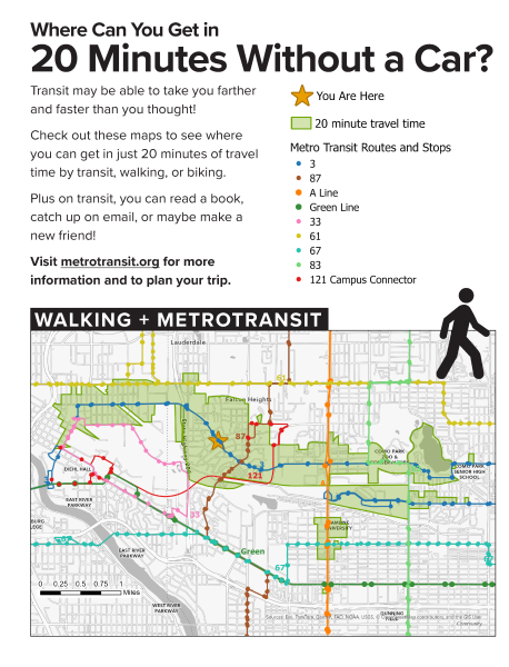
New posters on display at neighborhood businesses and other destinations show how far you can get without a car. Each poster has two maps customized to the location where it’s displayed.
The green area in this example shows how far you can reach by bus in 20 minutes from the St. Anthony Park Library at the intersection of Como and Carter avenues. Each full poster also shows a map with 20-minute travel distance if you combine biking and busing. (Did you know your bike can ride the bus too?)
Also notice how many transit routes run through and connect near the neighborhood.
Keep an eye out for the posters on your errands. Then use them, along with metrotransit.org, to plan your next trip without the car!
Tracy Kugler is a geographer and bike commuter who lives in the Como Park neighborhood.